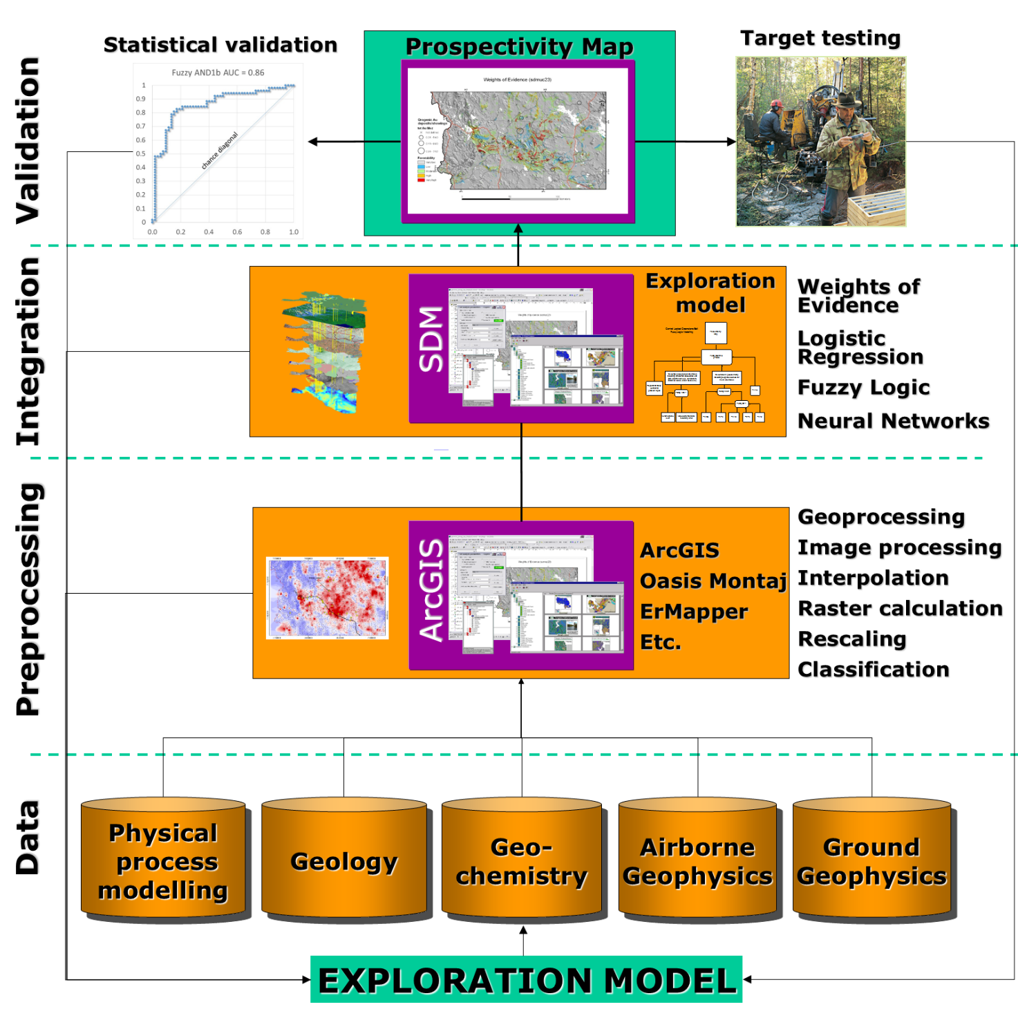
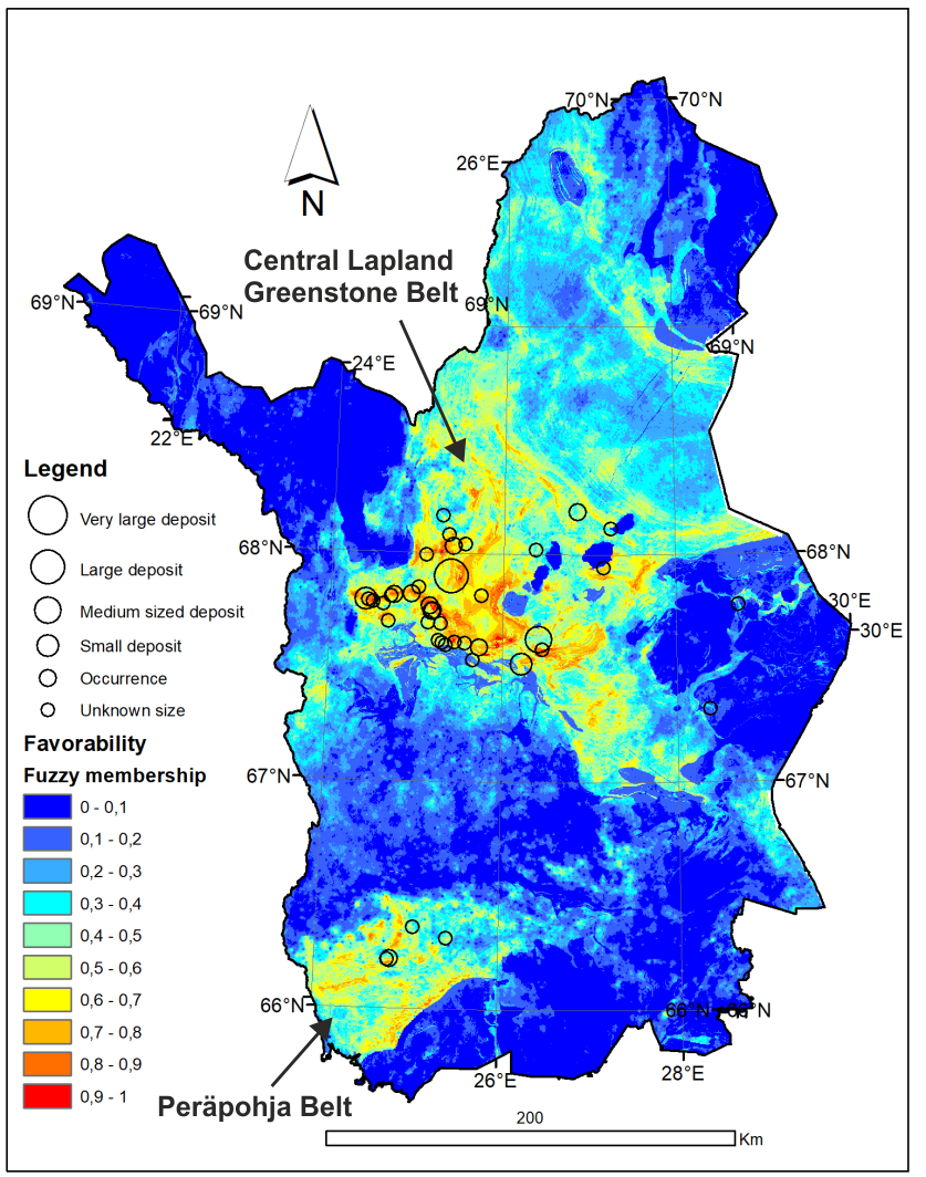
Digital geoscientific data can be used as spatially referenced layers of evidence in mineral prospectivity mapping, that is, ranking areas according to their exploration importance. A typical workflow of a prospectivity modelling project starts with definition of the exploration model. This can be based either on practical exploration expertise or on more academic approach using mineral systems model. The next step is to generate derivative maps defining proxies to the critical parameters of the mineral systems model in question using all the available related digital geoscience map data. Third step is the actual spatial modeling using various modeling techniques depending on the data available. The final step is the model validation and target testing.
(Last update: 20.05.2020)

