Orogenic gold mineral systems are typically associated with large scale fault systems that have evidently localized and focussed mineralizing fluids, with precipitation of ore deposits in domains of structurally enhanced permeability. Based on understanding of the coupling of fluid pressures and fault rupture in modern seismically active regions, the structural architecture of orogenic gold systems is relatively well understood.
This knowledge can be used in to assess prospectivity in conjunction with geophysical studies that reveal deep crustal structure, especially where petrophysical contrasts result in prominent reflectivity patterning in seismic surveys, or marked potential field gradients in gravity and magnetic data.
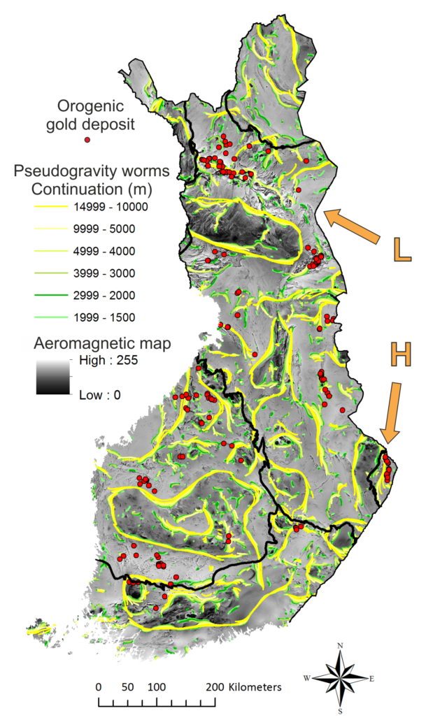
The map of Finland at right shows the distribution of known orogenic gold deposits and processed magnetic survey data, as both total magnetic field intensity (in halftones from light to dark grey) and as horizontal gradients enhanced using a wavelet-based transformation that in optimal situations, permits delineation of deeper crustal structures and discontinuities between different geological units. The resultant irregular yellow to green linear features, popularly known as pseudogravity ”worms”, indicate that anomaly sources may persist to depths of 10-15 km. Note that while some ”worms” circumscribe and coincide with intense magnetic anomalies at the surface, correlation with gold deposit distribution is not always straightforward. Good correlation exists in WNW-ESE trending Central Lapland (L) and the N-S trending Archean Hattu belt (H).
(Last update: 20.05.2020)
